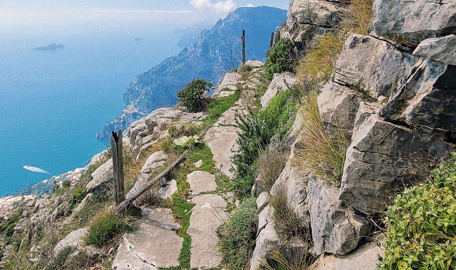
The Path of the Gods (Sentiero degli Dei) is the best-known walk on the Amalfi Coast: a high ledge trail from the hamlet of Bomerano, in Agerola, to Nocelle above Positano. It runs roughly 600 to 650 metres above the sea, with views over the Li Galli islets, the Faraglioni of Capri on a clear day and the whole Positano coastline. This guide covers the exact route, how to reach the start by public transport, what to carry, and when a guided walk is worth paying for.
Path of the Gods at a glance
| Route | Bomerano (Agerola) to Nocelle, then steps to Positano |
| Distance | Approximately 5.6 to 7.8 km to Nocelle (sources differ), about 1 km more to central Positano |
| Walking time | 2 to 3 hours to Nocelle; 3 to 4 hours including the descent to Positano |
| Height | Highest point approximately 650 m, Nocelle approximately 450 m |
| Difficulty | Easy to moderate, no technical sections, but uneven rock and unfenced edges |
| Cost | Free as of 2026; you pay only for buses and food |
| Waymarks | White and red signs, route number 02 (CAI 327) |
Published distances vary by several kilometres because guides count the start at different points in Bomerano and the finish at Nocelle, Arienzo beach or Positano centre. Treat the figures above as a range and rely on the time estimate instead.
Getting to Bomerano
The start is the weak point of the hike, because the bus service is infrequent and the route needs a change at Amalfi.
- From Amalfi: SITA buses to Agerola take about 40 minutes. Tell the driver you want Bomerano. In the April to October season a Travelmar shuttle also links the Amalfi ferry landing with Agerola.
- From Positano: there is no direct bus. Take the SITA coast bus to Amalfi, then change. Allow 90 minutes to 2 hours and leave early.
- From Sorrento: bus or ferry to Amalfi, then the Agerola bus. Allow 2 to 3 hours each way, which is why many people book a guided walk from Sorrento that includes the transfer.
- By car: Bomerano is reached on the SS366 from the A3 exit at Castellammare di Stabia. Free parking near Piazza Capasso is limited, so arrive before 9 am in summer. The walk ends in Positano, so you will need to come back for the car by bus or taxi, which makes driving a poor fit for this one-way hike.
Buy bus tickets in advance from a bar or tobacconist where possible, and check the current SITA timetable the day before: summer and winter schedules differ. Our Positano guide and getting around Italy page cover the coast bus in more detail.
The route, section by section
Bomerano to Colle La Serra (about 2 km). The path leaves the village between terraces and stone walls, then climbs gently onto the ridge. Early sections have the first sea views and a few rocky stretches. At Colle La Serra there is a junction: the waymarked fork for trail 327a avoids the most exposed ledges, a sensible choice if heights make you uneasy.
The ledge sections. The middle of the walk is the famous part: a narrow, worn path cut across the cliff with a drop on one side and wide views of the gulf on the other. It is not technical, but there are few railings, so keep children close and dogs on a lead. Do not attempt it in wet weather, when the limestone turns slippery.
Forest and descent to Nocelle. The final third drops through holm oak and chestnut woodland, where you finally get shade, then arrives in Nocelle. There are restaurants and toilets here. La Tagliata, in the hills a short way from Nocelle, is a well-known lunch stop and benefits from advance booking, as does the kiosk near the end of the trail (Chiosco degli Dei).
Nocelle to Positano. The famous final stretch is a stone staircase of roughly 1,500 to 1,800 steps (counts differ by source, with 1,700 the figure often quoted) dropping about 450 to 500 metres to the main road at Arienzo, then about 1 km on the pavement into central Positano. Allow 40 to 60 minutes. The steps are shaded in places but hard on knees, so use poles if you have them. Two alternatives exist: a local bus from Nocelle to Positano on a seasonal timetable, or the gentler 3.5 km Montepertuso path, which takes 1 to 1.5 hours.
What to carry
- Water: at least 1.5 litres each. Apart from the restaurants at either end, there is no reliable supply on the trail.
- Shoes: hiking shoes or trainers with a proper grip, not sandals.
- Sun cover: a hat and sunscreen, because most of the path is exposed.
- Food: buy fiordilatte mozzarella, bread and fruit in Agerola before you start.
- Navigation: download an offline map. Mobile signal comes and goes along the ridge.
- Cash: small notes for bus tickets and the village cafes.
When to go
Spring and autumn are best. In July and August the trail is very hot and busy by mid-morning, so start by 8 am or skip it. In winter, rain and low cloud can wipe out the views and make the rock slick. Our best time to visit Positano guide has month-by-month weather and crowd detail for the area.
Guided walks versus going alone
Walking independently is straightforward in good weather, and the route is signed. The reasons to book a guided walk are logistics and context: the guide handles the awkward Bomerano transfer, picks the right fork for your group and explains the terraces, lemon groves and old mule paths. Many Path of the Gods guided walks leave from Sorrento and bring you back, which removes the two-leg bus journey. If you are based in Positano, check Positano tours or our best tours in Positano roundup for walks that start from the village.
Where to stay for the hike
Positano is the natural finish and puts you at the bottom of the steps with food and the beach nearby, but it is expensive. Praiano and Amalfi cost less and shorten the bus journey to Bomerano. See our where to stay in Positano and Amalfi Coast hotels guides to compare areas.
Plan the rest of the day
Allow time for a swim or a late lunch in Positano after the descent; the main beach is at the foot of the village. For a wider plan, see our Amalfi Coast itinerary, which places the hike on the Positano and Praiano day, and our Amalfi Coast hub. Local background on the route, including transport updates, is on the official Positano tourism page for the Sentiero degli Dei. Distances, bus schedules and trail conditions change, so check them before you go (as of 2026).