The Dolomites are a UNESCO World Heritage Site for good reason - sheer rock towers of Ladinian limestone rising from green meadows, with trail systems that range from easy cable-car-assisted strolls to multi-day high routes requiring mountain experience. This guide covers the three hikes that matter most and how to approach them.
Top Tours at a Glance
Here’s a quick comparison of top-rated tours on GetYourGuide:
| Tour | Duration | Price (from) | Group Size | Highlights |
|---|---|---|---|---|
| Tre Cime di Lavaredo Guided Half-Day Hike | 4–5 hrs | from €55/person | Small group (max 10) | Certified mountain guide, Tre Cime circuit, geological commentary |
| Seceda Ridge Walk with Cable Car | 3–4 hrs | from €65/person | Small group | Cable car included, Odle panorama, Val Gardena views |
| Dolomites Full-Day Hiking Experience | 7–8 hrs | from €90/person | Small group (max 8) | Certified alpine guide, multiple peaks, rifugio lunch stop |
| Alta Via Via Ferrata Introduction | 4 hrs | from €75/person | Small group (max 6) | Harness and equipment provided, certified guide, beginner-friendly |
Browse all Dolomites hiking tours → GetYourGuide
Tre Cime di Lavaredo circuit
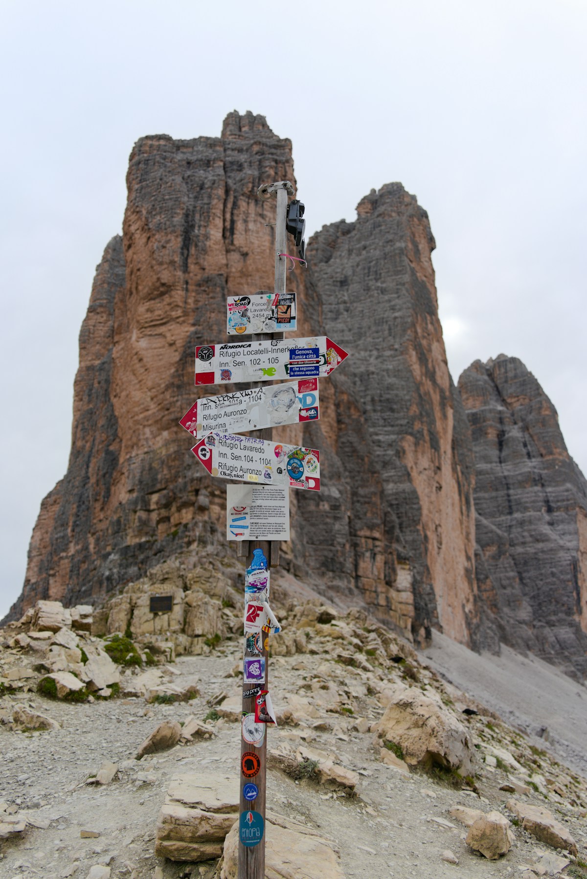
The three jagged peaks of the Tre Cime are the defining image of the Dolomites - rising 2,999m from the Sesto Dolomites plateau and visible from almost every direction across the range. The circuit hike around their base is one of the most popular alpine walks in Europe, and genuinely deserves the reputation.
The route: Starting from Rifugio Auronzo (2,320m, reachable by toll road and car park), the circuit runs anticlockwise around the three peaks on well-maintained trails - total distance approximately 10km, elevation gain around 450–500m. Allow 3.5–4.5 hours at a comfortable walking pace.
Key sections:
- North face view: The most dramatic angle - massive sheer walls drop several hundred metres from the peaks. Reached on the trail between the Auronzo and Lavaredo rifugi.
- Forcella Col de Mezzo (2,315m): The pass on the south side giving views toward the Val Fiscalina.
- Rifugio Lavaredo (2,344m): Good stop for coffee or lunch mid-route with direct views of the peaks.
- Rifugio Locatelli (2,405m): On the north side; views of the Tre Cime silhouetted against the Sesto plateau. Worth the additional 30-minute climb from the main circuit.
Toll road and parking: A toll road from Misurina to Rifugio Auronzo charges approximately EUR 30 per car as of 2026 (open mid-June to mid-October, weather permitting). Arrive before 8am in July and August - the car park fills by 9am and creates queues back down the mountain. The shuttle bus from Misurina (approximately EUR 8 return as of 2026) is the lower-stress option and eliminates the parking anxiety entirely.
Difficulty: Moderate. Good footwear essential - proper hiking boots with ankle support rather than trainers. No technical climbing required but the trail is uneven and loose-stone in sections.
Guided options: Dolomites guided hike tours operate the Tre Cime circuit with naturalist guides; expect EUR 40–70 per person for a small-group guided half-day. Worth it for the geological and ecological commentary - the formation story of the Dolomites (reef limestone from a Triassic sea, not volcanic rock) is extraordinary in context.
Seceda: the cable car hike
Seceda in the Val Gardena is the Dolomites’ most accessible dramatic landscape - a cable car from Ortisei (1,235m) rises to the Seceda plateau (2,520m) and delivers you directly into a high alpine ridge walk with panoramic views of the Odle/Geisler group and the entire Val Gardena below.
The route options:
- Easy ridge walk (2–3 hours, minimal elevation gain): From the cable car top station, follow the ridge path west toward the Col Raiser area. The path is wide and well-maintained; families with older children manage this comfortably. Elevation change on the ridge is minimal - the cable car does the work.
- Furcela de Furcia descent (4–5 hours, moderate): A longer route descending toward Bressanone through mountain pastures, then a connection to St. Peter and bus back. Requires proper hiking boots and confidence on steep sections.
- Connection to the Odle Plateau: A more technical route requiring good conditions and experience; views of the Odle towers are unmatched.
Cable car: Ortisei (Urtijëi in Ladin) cable car to Seceda runs from approximately mid-June to mid-October. Return ticket approximately EUR 28 as of 2026. Book online in peak season - the gondola queues get long.
Val Gardena access: Ortisei is 45 minutes from Bolzano by bus, 2 hours from Innsbruck by rail and bus. In season, the Dolomites bus network (SAD buses) connects the valley towns frequently without needing a car.
Best views: The Odle/Geisler group - seven dramatic rock spires rising from the plateau - is most striking in morning light. Afternoon thunderstorms are common in July and August; plan to be below the ridgeline by 2pm.
Difficulty: Easy to moderate depending on which route you choose. The cable car-assisted ridge walk is suitable for most fitness levels. The longer descent routes require appropriate footwear and stamina.
Alta Via 1: the classic multi-day route
The Alta Via 1 is the Dolomites’ defining long-distance route - 120km from Lago di Braies (Pragser Wildsee) to Belluno, crossing multiple passes, staying in mountain rifugi, and traversing the full Dolomites landscape from north to south. Most hikers complete it in 9–12 days.
Key stages (north to south):
- Stage 1–2 (Braies to Refugio Fanes): Through the Fanes-Senes-Braies Nature Park. Relatively gentle introduction; Rifugio Fanes is one of the most comfortable huts on the route.
- Stage 3–4 (Fanes to Cortina d’Ampezzo): Crossing the Falzarego Pass (2,105m) and descending to Cortina. The Tofane group dominates the western horizon.
- Stage 5–6 (Cortina through the Pelmo group): The most technically demanding middle section; some exposed ridge traverses require care.
- Stage 7–9 (Pelmo to Civetta to Alleghe): Quieter terrain, fewer day-trippers, excellent rifugi with authentic local food.
- Stage 10–12 (Civetta to Belluno): The route descends steadily from alpine to pre-alpine terrain; a satisfying close.
Rifugi (mountain huts): The route is entirely rifugio-to-rifugio - no camping required or recommended. Huts provide dormitory or private rooms (book months ahead for July–August), dinner, and breakfast. Expect to pay approximately EUR 60–90 per person per night (dinner-bed-breakfast) in a mid-range rifugio as of 2026.
Guided Alta Via options: Fully guided Alta Via 1 packages (guide + rifugi pre-booked + luggage transfers for the approach stages) run approximately EUR 1,200–1,800 per person for 9–10 days. Self-guided with pre-booked rifugi is cheaper and works well for experienced hikers. Book rifugi online 3–6 months before a summer walk.
Best season for Alta Via: Mid-July to mid-September. Early July can still have snow on passes above 2,400m. After mid-September, rifugi begin closing and weather windows shorten.
Practical guide: what to bring
| Item | Essential? | Notes |
|---|---|---|
| Hiking boots (ankle support) | Yes | Trainers are inadequate on the uneven Dolomite paths |
| Waterproof jacket | Yes | Afternoon thunderstorms come fast |
| Trekking poles | Recommended | Especially on descent sections and multi-day routes |
| Sun protection | Yes | High altitude UV is intense; lips and ears burn quickly |
| 1.5L+ water | Yes | Rifugi sell water but springs between huts are variable |
| Emergency space blanket | Recommended | Weather changes rapidly above 2,000m |
| Headtorch | Multi-day only | Early starts before rifugi illuminate paths |
Via ferrata equipment: If adding any via ferrata routes (there are dozens across the Dolomites), you need a harness, helmet, and via ferrata set (Y-shaped lanyard with energy absorbers). All rentable in Cortina, Ortisei, and Bolzano. A guide is strongly recommended for first-timers - the route grades (1A easiest to 6 hardest) are not always intuitive.
Getting there
By train: Bolzano (Bozen) is the main gateway - 3.5 hours from Milan, 2 hours from Verona. From Bolzano, SAD buses serve most Dolomite valley towns year-round.
By car: Best for flexibility between multiple base towns. Parking at major trailheads (Tre Cime, Seceda) is limited in peak season - plan early arrivals. The Dolomiti Superski ski resort infrastructure means roads are unusually well-maintained for mountain country.
Accommodation bases:
- Cortina d’Ampezzo: Expensive, excellent, best for the central Dolomites. Alta Via 1 midpoint.
- Ortisei/Val Gardena: Best base for Seceda, Alpe di Siusi, and the western Dolomites.
- Dobbiaco/Toblach: Gateway town for Tre Cime and the Sesto Dolomites.
Our recommendation
One day: The Tre Cime circuit - start by 7:30am from Rifugio Auronzo to beat the crowds. Allow 4 hours, build in time at Rifugio Locatelli for the north face view.
Three days: Add Seceda on day 2 (cable car up, ridge walk) and a half-day via ferrata (with a local guide from Cortina or Ortisei) on day 3.
Ten days: Walk the Alta Via 1 from Braies to Belluno. Book rifugi in February for a July walk.
Our northern Italy itinerary puts the Dolomites in a wider route that includes Venice, Verona, and the Veneto. For accommodation options across the region, our Italy hotels guide covers the best bases by area.